-

-
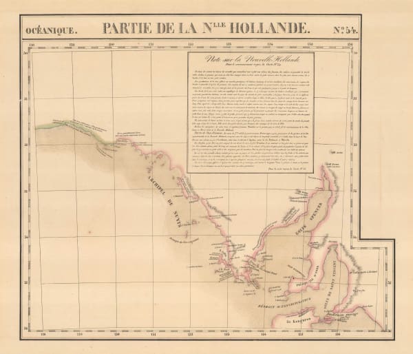
Matthew Flinders, Chart of Terra Australis: South Coast Sheet IV, 1814£ 3,850.00
-
Philippe Vandermaelen, South Australia & Adelaide, 1827£ 645.00
-
Royal Geographical Society (RGS), Country near the Mouth of the River Murray, 1833£ 145.00
-
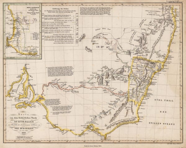
Justus Perthes, Karte von dem Sudostlichen Theile Australia's, 1834£ 375.00
-
Royal Geographical Society (RGS), Sketch Map of the Country East of Flinders' Range, 1844£ 98.00
-
John Tallis, Part of South Australia, 1851£ 425.00
-
John Arrowsmith, The South Eastern Portion of Australia compiled from Colonial Surveys, 1853£ 2,250.00
-
Justus Perthes, Die Entdeckungen im Innern von Sud-Australien, 1860£ 72.00
-
Royal Geographical Society (RGS), Map to Illustrate Diaries of Exploration of Central Australia by John McDouall Stuart Esq., 1861£ 375.00
-
Justus Perthes, Entdeckungen von Warburton, Walder, Kramer & Meissel im Cooper Delta, 1867£ 88.00
-
Justus Perthes, Warburton's Entdeckung des Nordendes von Lake Eyre 1866, 1867£ 65.00
-
Justus Perthes, Ubersicht der Neuesten Reisen & Aufnahmen in Seecebiet von Central-Australien, 1870£ 52.00
-
Royal Geographical Society (RGS), Map Shewing the Overland tracks from Perth to Eucla & Adelaide, 1871£ 695.00
-
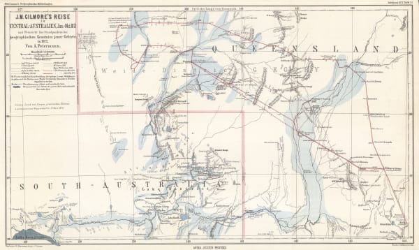
Justus Perthes, J.M. Gilmore's Expeditions in Southwest Queensland, 1872£ 68.00
-
Justus Perthes, J. W. Lewis' Aufnahman im Norden und Osten des Eyre Sees, 1874/5, 1875£ 64.00
-
Royal Geographical Society (RGS), Map of the Explorations from Beltana Station to the City of Perth, 1876£ 585.00
-
Justus Perthes, Thomas Elders' Expedition durch Inner Australia, 1876£ 195.00
-
Royal Geographical Society (RGS), Part of Central Australia, 1884£ 115.00
-
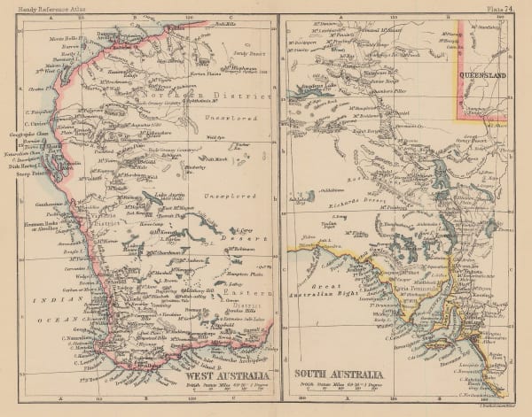
John Bartholomew, West Australia | South Australia, 1887£ 58.00
-
W. & A.K. Johnston, South Australia, New South Wales and Victoria, 1890 c.£ 95.00
-
Letts & Son, Australia, 1892£ 82.00
-
Edward Stanford, South Australia, 1898£ 58.00
-
E. Baudelot, Adelaide, 1911£ 62.00
Close
Search Inventory
Our entire inventory of over 10,000 antique and vintage maps is now available to browse by region, date, cartographer, and subject


Join our mailing list
* denotes required fields
We will process the personal data you have supplied to communicate with you in accordance with our Privacy Policy. You can unsubscribe or change your preferences at any time by clicking the link in our emails.
![]()