-
 Louis-Claude de Freycinet, Carte D'Une Partie De La Terre De Witt (a la Nouvelle Hollande), 1811£ 495.00
 -
Louis-Claude de Freycinet, Carte d'une partie De La Terre De Witt (A La Nouvelle Hollande), 1811£ 550.00
-
Louis-Claude de Freycinet, Carte d'une partie De La Terre De Witt (A La Nouvelle Hollande), 1811£ 550.00
-
Louis-Claude de Freycinet, Carte d'une partie De La Terre De Witt (A La Nouvelle Hollande), 1811£ 950.00
-
-
Philippe Vandermaelen, Océanique - Partie de la Nle. Hollande - No. 44, 1827£ 495.00
-
Philippe Vandermaelen, Océanique - Partie de la Nlle. Hollande - No. 52, 1827£ 625.00
-
Philippe Vandermaelen, Océanique Partie de La Nlle. Hollande. No. 53, 1827£ 445.00
-
Philippe Vandermaelen, Océanique. Partie de la Nlle. Hollande - No. 50, 1827£ 445.00
-
Philippe Vandermaelen, Océanique. Partie de la Nlle. Hollande No. 35, 1827£ 345.00
-
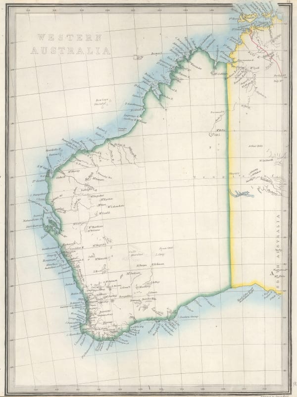
Royal Geographical Society (RGS), Western Australia from the latest Documents received in The Colonial Office, 1832£ 1,350.00
-
Society for the Diffusion of Useful Knowledge (SDUK), Western Australia | Van Diemen Island, 1833£ 135.00
-
Royal Geographical Society (RGS), Australia: N.W. Coast, 1838£ 110.00
-
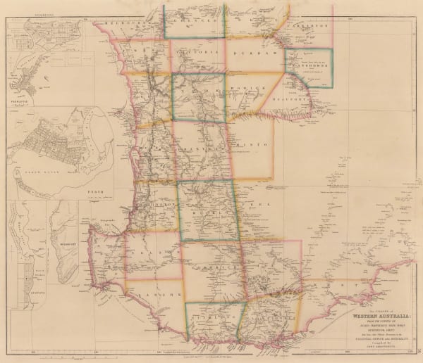
John Arrowsmith, The Colony of Western Australia, 1839£ 2,450.00
-
Royal Geographical Society (RGS), Part of Western Australia to Illustrate the Journals of Messrs. Gregory & Lieut. Helpman. R. N., 1848£ 175.00
-
John Tallis, Western Australia: Swan River, 1851£ 475.00
-
Royal Geographical Society (RGS), Western Australia, 1852£ 265.00
-
Royal Geographical Society (RGS), Map to Illustrate The Report of an Expedition into The Interior of Western Australia, 1856£ 85.00
-
Royal Geographical Society (RGS), Map of North Western Australia, 1862£ 285.00
-
Justus Perthes, Provisorische Karte von Frank Gregory's Reisen in Nordwest-Australien, 1862£ 78.00
-
Royal Geographical Society (RGS), Map Shewing the Overland tracks from Perth to Eucla & Adelaide, 1871£ 695.00
-
Royal Geographical Society (RGS), Western Australia, 1872£ 195.00
-
James Wyld, Western Australia, 1874£ 145.00
-
Justus Perthes, West-Australien, 1875£ 125.00
-
Royal Geographical Society (RGS), Map of the Explorations from Beltana Station to the City of Perth, 1876£ 585.00
-
Justus Perthes, Thomas Elders' Expedition durch Inner Australia, 1876£ 195.00
-
Justus Perthes, Thomas Elders' Expedition durch Inner-Australien, 1880 c.£ 185.00
-
Justus Perthes, Der Kimberley Distrikt in Nordwest Australien, 1884£ 68.00
-
Scottish Geographical Society (SGS), Physical Sketch Map of North-West Australia, 1885£ 275.00
-
John Bartholomew, West Australia | South Australia, 1887£ 58.00
-
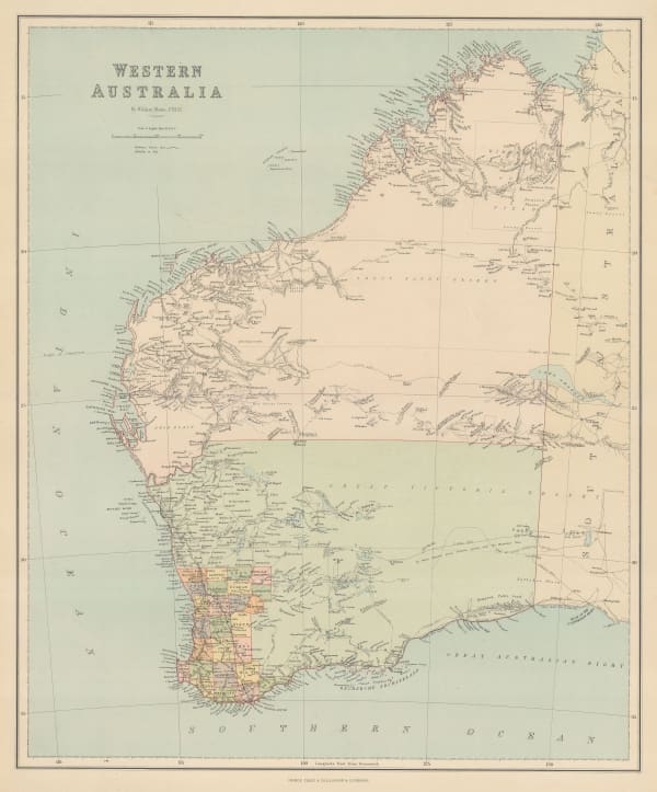
George Philip & Son Ltd., Western Australia, 1890£ 145.00
-
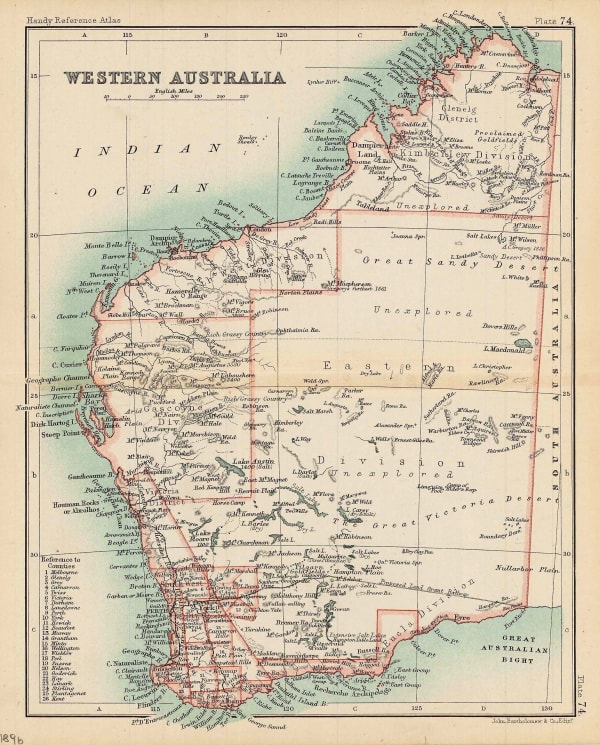
G. & J. Bartholomew, Western Australia, 1896£ 62.00
-
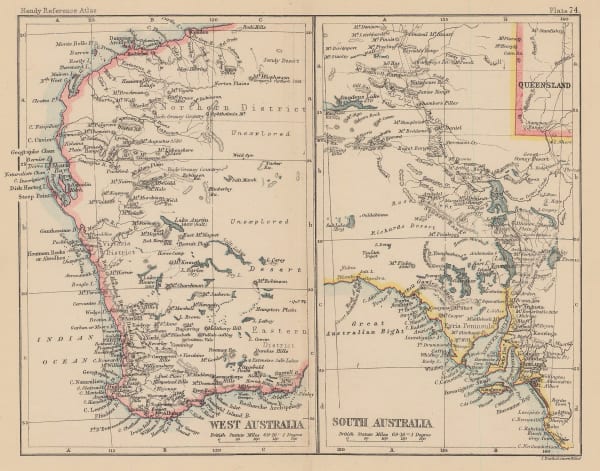
Royal Geographical Society (RGS), Eastern Part of West Australia, 1898£ 295.00
-
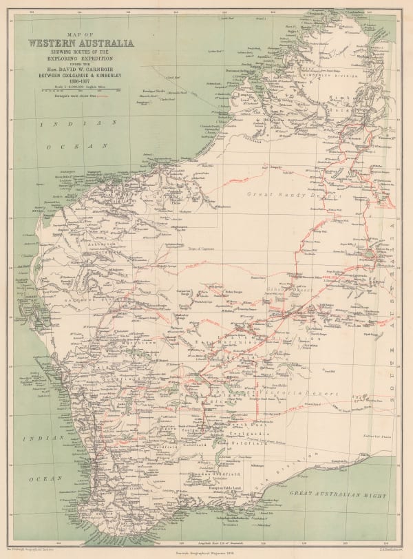
Scottish Geographical Society (SGS), Map of Western Australia Showing Routes of the Exploring Expedition, 1898£ 495.00
-
E. Baudelot, Perth, 1911£ 75.00
-
Royal Geographical Society (RGS), Lake System of Westralia, 1914£ 225.00
-
Australian Survey Co, Western Australia - Perth, 1919£ 1,250.00
-
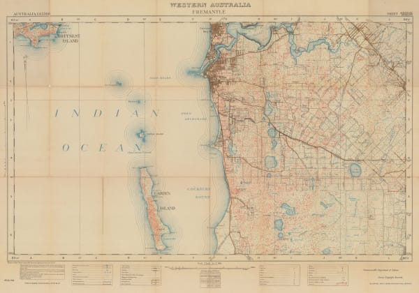
Australian Survey Co, Western Australia - Fremantle, 1921£ 1,250.00
-
Frederick William Simpson, Western Australian Government Tramways System, 1930£ 950.00
-
Royal Geographical Society (RGS), Map combining the work of the Mackay Aerial Survey Expedition 1930 and of the Terry Expeditions 1932 and 1933, 1934£ 245.00
Close
Search Inventory
Our entire inventory of over 10,000 antique and vintage maps is now available to browse by region, date, cartographer, and subject


Join our mailing list
* denotes required fields
We will process the personal data you have supplied to communicate with you in accordance with our Privacy Policy. You can unsubscribe or change your preferences at any time by clicking the link in our emails.
![]()